Shetland Pilgrimage 2021
Before Covid struck, I was planning a long pilgrimage to Rome along the Via Francigena. That seems now like an impossible dream, but a friend told me of a virtual pilgrimage he was making in support of the Friends of the Holy Land. He was walking in stages near his home a distance equivalent to the journey from Bethlehem to Nazareth. The idea was to raise funds for the school fees of Christian families in the Holy Land, many of whom have lost their source of livelihood during the collapse of the pilgrimage and tourist industries.
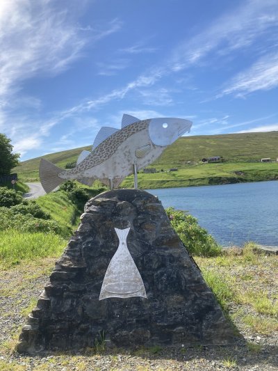
The distance from Bethlehem to Nazareth is much the same as the length of the main island of Shetland, so I decided to walk from Sumburgh Head to North Roe in stages through the month of June. This is the most beautiful season in the Northern Isles, with the simmer dim and the land vibrant with birds and flowers.
I wanted to support disadvantaged the disadvantaged Christian school children in the Holy Land, but I saw it also as an opportunity to celebrate the 1500th anniversary of the birth of St Columba of Iona by visiting as many as possible of the sites associated with the Celtic monks who brought the faith to the Shetland Islands. Other parishioners and a Church of Scotland Minister joined me for sections of the walk and we formed a team, "Shetland Pilgrimage". What follows is a transcript of the daily blog I posted on the charity's website.
Day 1. Sumburgh Head to Robins Brae. Distance: 10.89 miles.
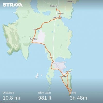
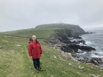
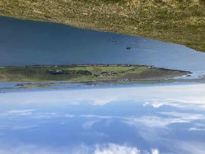
We started the pilgrimage on Monday 31st May. Marsali joined me for the first four miles and we did a loop from Jarlshof to Sumburgh Head. No sign of puffins. The lighthouse was quite atmospheric with the swirling mist. I had to get permission to cross the airstrip but it was a technicality since all flights today had been cancelled because of low visibility. From Toab I walked along the beach of Quendale Bay, then on minor roads through Quendale, Dunrossness and Boddam, returning to Lerwick by bus. Total distance 10.8 miles, equivalent to the distance from Bethlehem to the Holy Sepulchre in Jerusalem. The picture is of Marsali with Sumburgh lighthouse in the background. This is the southern tip of Shetland Mainland.
Day 2. Robins Brae to Sandwick. Distance 12.94 miles.
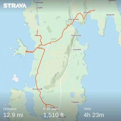
Fog again first thing, but it cleared to a glorious summer's day when I crossed to the west coast. This is one of the most fertile parts of Shetland with dairy and arable farms besides the ubiquitous sheep. There were seals sunning themselves on the beach at Reawick Bay. Since this is a pilgrimage in honour of St Columba I detoured to St Ninian's Isle. The chapel there may have been founded in the the seventh century by Celtic monks. I also sought traces of the Norse period steeple Kirk at Ireland, but found only a Methodist chapel. Today's route almost completely avoided the main road. I cut down to Channerwick Bay cross country and reached Sandwick via Rompa and the pretty fishing village of Hoswick.
Day 3. Sandwick to Quarff. Distance 11.59 miles.
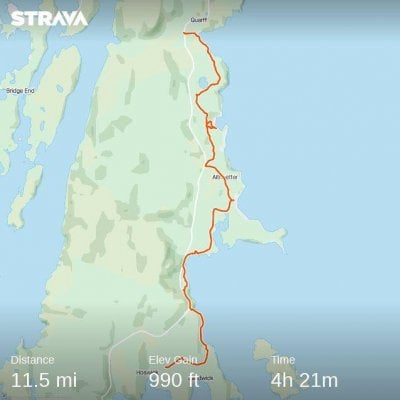
Only eleven and a half miles today but it felt like much more! The sun was strong and most of the walk today was off-road. I followed the coast along Mousa Sound, opposite the famous Iron Age defensive broch. A display board said it was one of the best places in Britain to see whales, porpoises and seals but none broke surface while I was there. North of Cunningsburgh I visited the abandoned village of Fladderbister. A group of old crofts from the eighteenth and nineteenth centuries are roofless but give a good idea of what Shetland was like up to the 1930s. There are also two well preserved lime kilns. I was bracing myself for a five mile stretch of main road but found an access path leading to Fladderbister Loch and the coast. The track soon disappeared and I had to pick my way through heather, rock outcrops and bogs. I feel I have a better understanding now of what is meant by the 'trackless desert'. It was with some relief that, on clearing a ridge, I spotted the familiar outline of Quarff Kirk.
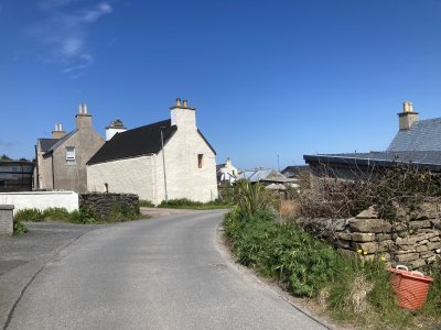
Day 4. Quarff to Scalloway. Distance 4.8 miles.
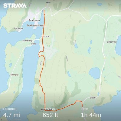
A short section down the Quarff valley, then following the ridge cross-country along the west coast to Scalloway. I was accompanied by Pete and David. Wonderful views over Tondra and Bura right out to Foula. One of the islands of this group is called Papa, normally a sign of a Celtic monastic presence. Our end point, Scalloway, was the administrative centre of Shetland until the eighteenth century. The ruined castle dates from the early 1600s and was the home of the Stewart earls.
Day 5. Papil to Scalloway and Lerwick. Distance 17.85 miles.
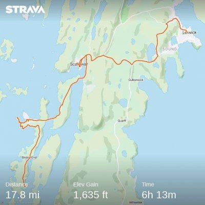
Today is the feast of St Columba. I branched off my route to visit Papil on Burra Isle, a Celtic monastic site. The isles of Burra and Todra are joined to the mainland by fixed links. Visited the lighthouse at Hamnavoe then on to Scalloway where I rejoined my route. I would have been too late for my bus at Tingwall so continued to Lerwick. 17 miles total. Steady drizzle p.m.
Day 6. Lerwick to Bressay and Noss. Distance 9.48 miles.
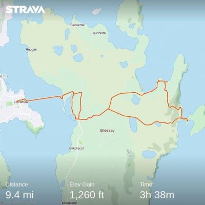
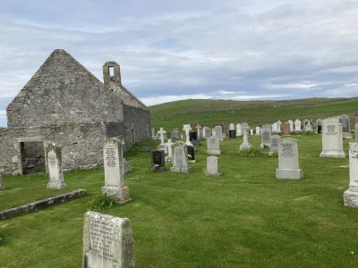
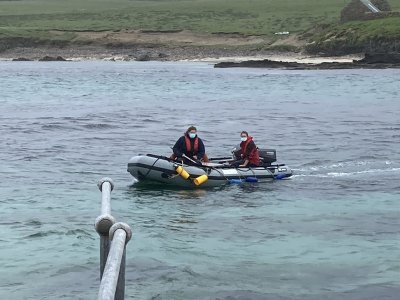
Crossed Bressay Sound, Lerwick's harbour, with Pete. Low cloud and light rain meant we were in and out of waterproofs all day. Crossed to the island of Noss, a National Nature Reserve, in a rubber dinghy. The wind was picking up and a heavy swell was making the crossing dangerous so the Warden decided to return us almost immediately to Bressay. Just time to find the site of the Pictish chapel where shrine fragments were found in excavations. We climbed Ander Hill to the First World War lookout, then down to the early Christian churc site at Cullingsbrough, beside an Iron Age broch. The Bressay Stone was found near here. This is the furthest east we shall go. Returning now to the main journey north.
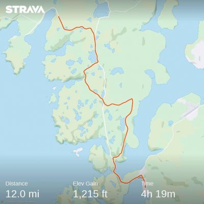
Day 7. Lerwick to Bixter. Distance 16.16 miles.
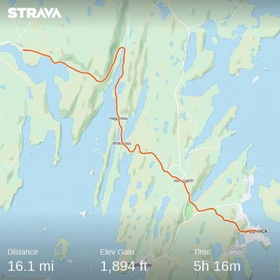
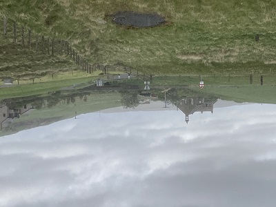
High winds and intermittent rain. Apart from two short cuts I kept mainly to the roads. My route has taken me in a NW diagonal line to the West Side through the Tingwall valley back to the west coast. The photo is of Weisdale. In the nineteenth century clearances 300 families were evicted from this fertile limestone valley to create pasture for sheep. Many emigrated. In the backgound is Upper Kergord which is soon to be transformed by the largest windfarm in Europe. It is expected to supply much of Scotland's energy requirements and for the first time Shetland will be connected to the national grid.
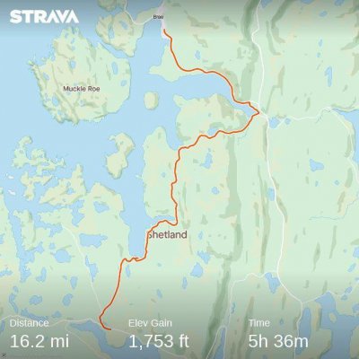
Day 8. Bixter to Brae. Distance 16.27 miles.
I completed exactly 100 miles at Brae bus stop. Definitely in the north now. The first part of the day took me through hilly, but scenic, terrain from Aith to Voe. The second part was more difficult going, on steep sheep tracks along the coast. I was glad to find an alternative to the hard shoulder of the highway. Voe is one of my Mass centres. The photo shows a monument to the opening of Voe Marina.
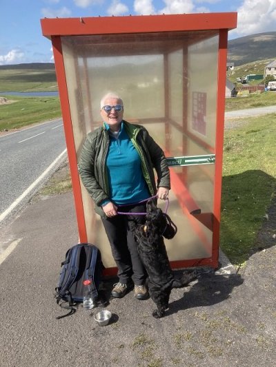
Day 9. Brae to Urafirth. Distance 12.07 miles.
I was joined today by the Rev. Lynn Brady, Church of Scotland Minister for northern Shetland - and Max, her two year old dog. We crossed the narrow isthmus at Mavis Grind into Northmavine. This is volcanic territory. Shetland has a really complex geology. From Sullom we were able to look across to the huge industrial plant at Sullom Voe, once the centre of the North Sea oil operation. One cross-country section near Gunnister. The scenery was almost Alpine. At 12 miles, this was Max's longest ever walk but he was still playful at journey's end. Almost there now. My final destination of North Roe is about ten miles away.
Day 10. Urafirth to North Roe. Distance 10.12 miles.
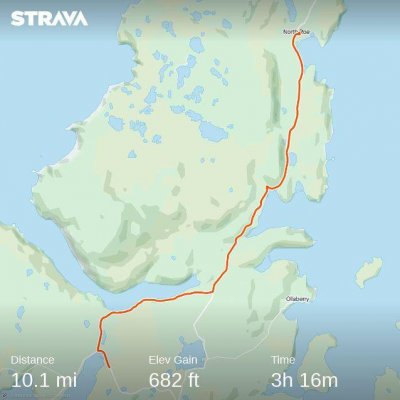
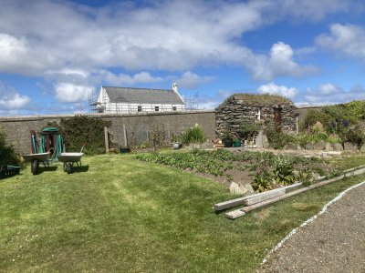
I started my walk along Ronas Voe, which is dominated by Ronas Hill. At 450 metres it is Shetland's highest point. The hill is the eroded magma chamber of an extinct volcano. Continuing northwards, I passed near to the breeding grounds of Arctic terns and they swooped on me repeatedly to drive me off. The Shetland name of tirricks better suggests their character. Marsali joined me for the last section into North Roe, where we were given a warm welcome by the volunteers in a beautiful community garden alongside the old Kirk. This is our Nazareth. We have reached the end of our journey, 122.2 miles from Sumburgh.
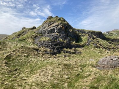
Coda. Point of Fethaland. Distance: 8.87 miles.
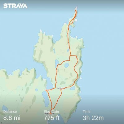
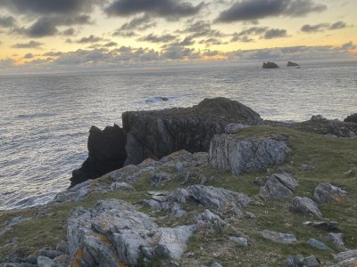
The road ends soon after North Roe, but there is a promontory which extends about five miles further north. I decided to return in the evening to complete the island "end to end". It was the summer solstice and I arrived at the headland at 11 p.m. when the last rays of the settings sun were still showing on the horizon. I walked until 1 a.m. and it remained light throughout. This extension also gave me an opportunity to visit Kame of Isbister, thought to be a Celtic hermitage site. A tranquil end to the pilgrimage. The photo shows the Point of Fethaland in the "Simmer Dim".